Exclusive deals on outdoor gear await!
Best GPS Devices for Off-Grid Adventures: Top 7 Rugged Navigation Tools
The best GPS devices for off-grid adventures with our top 7 rugged navigation tools. These reliable and durable devices ensure accurate navigation and safety, making them essential for any wilderness expedition.
2/11/20255 min read
Best GPS Devices for Off-Grid Adventures: Top 7 Rugged Navigation Tools for 2025
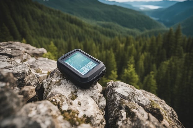
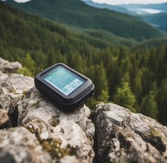
Modern GPS devices transform off-grid adventures from challenging navigation puzzles into seamless outdoor experiences. The Garmin GPSMAP 66i and Garmin Montana 700i stand out as top choices for outdoor enthusiasts, offering reliable satellite connectivity, detailed topographic maps, and extended battery life.
Off-road navigation demands specialized GPS units built to withstand harsh conditions while maintaining precise location tracking. These rugged devices provide critical features like emergency SOS signals, weather forecasts, and waypoint marking that smartphone apps cannot match.
GPS technology has evolved to offer advanced features specifically designed for wilderness exploration. The latest models integrate multiple satellite networks, including GPS, GLONASS, and Galileo, ensuring consistent coverage even in remote locations with dense tree cover or steep terrain.
Essential Features of Off-Grid GPS Devices
Modern off-grid GPS devices combine rugged construction, extended battery life, reliable satellite reception, and intuitive controls to keep adventurers on track in remote locations. These critical features work together to provide reliable navigation when cellular signals and power sources are unavailable.
Rugged Design and Durability
GPS devices for off-grid use feature reinforced casings made from impact-resistant materials like military-grade plastic and rubber armor. Many units meet the IP67 or IP68 rating standards, protecting against dust, water submersion, and drops up to 6 feet.
Scratch-resistant screens use hardened glass or protective coatings to withstand rough handling and extreme conditions. Quality units operate in temperatures from -20°F to 140°F.
Sealed battery compartments and weatherproof port covers prevent moisture damage to internal components. Secure mounting points allow attachment to backpacks, vehicles, or equipment without risk of detachment.
Battery Life and Power Options
Premium off-grid GPS units offer 15-20 hours of continuous use on a single charge. Replaceable AA batteries provide flexibility when recharging isn't possible.
Built-in lithium-ion batteries can be recharged via USB, solar panels, or portable power banks. Many devices include power-saving modes that extend battery life by dimming screens and reducing GPS polling frequency.
Dual-battery systems allow hot-swapping without powering down the device. Battery level indicators help users monitor power status and plan accordingly.
High-Sensitivity GPS and GLONASS Reception
Advanced GPS chips acquire signals quickly and maintain connection under dense tree cover. Dual GPS/GLONASS compatibility increases satellite coverage and position accuracy.
Multi-band antennas reduce interference and improve reception in challenging terrain. Position accuracy typically ranges from 3-5 meters under open sky.
Regular satellite updates ensure accurate location data every 1-2 seconds. Enhanced receivers maintain signals in canyons, thick forests, and other areas with limited sky visibility.
User-Friendly Interface with Touchscreen Display
Bright, sunlight-readable displays offer clear visibility in direct sunlight. Screen sizes range from 2.6 to 7 inches, with higher resolutions providing detailed map viewing.
Responsive touchscreens work with gloves and in wet conditions. Physical buttons complement touch controls for reliable operation in all environments.
Customizable dashboards display essential navigation data like coordinates, elevation, and compass heading. Intuitive menus and icons make accessing key features quick and simple.
Advanced Navigation and Mapping Tools
Modern GPS devices offer sophisticated features that extend beyond basic navigation, combining detailed mapping capabilities with smart tracking functions for enhanced outdoor experiences.
Topographic Maps and Offline Capabilities
GPS units store detailed topographic maps showing terrain features, elevation contours, and natural landmarks. These maps work without cellular service or internet connectivity.
Key offline features:
Pre-downloaded regional map packages
3D terrain visualization
Elevation profiles
Water sources and geographical features
Premium devices include global map coverage with regular updates through satellite data. The maps typically show trail networks, campsites, and points of interest.
Route Planning and Trail Information
GPS devices enable precise route creation before heading outdoors. Users can map multiple waypoints and calculate distances between key locations.
Planning tools include:
Distance calculations
Elevation gain/loss metrics
Estimated travel times
Alternative route suggestions
Many units display trail difficulty ratings and seasonal accessibility information. Advanced models factor in terrain type and weather conditions when suggesting routes.
Waypoints, Location Tracking, and Real-Time Tracking
GPS devices record location data at regular intervals, creating detailed activity logs. Users can mark specific points of interest as waypoints for future reference.
Common tracking features:
Current speed and heading
Distance traveled
Average pace
Location sharing capabilities
The devices store track logs that show exact paths taken, helping users retrace their steps or share routes with others.
Integration with Smartphone Apps and Web Platforms
Modern GPS units sync with mobile apps and online platforms through Bluetooth or Wi-Fi connections. This integration enables route sharing and community features.
Popular integration options:
Cloud backup of tracks and waypoints
Social sharing of routes
Weather forecasts
Trail condition updates
Users can transfer data between their GPS device and phone, combining the reliability of dedicated hardware with smartphone convenience.
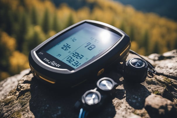
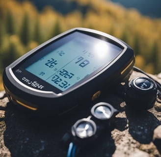
Top Off-Grid GPS Devices on the Market
Modern GPS devices offer reliable navigation and safety features for remote adventures, combining satellite positioning with rugged durability and extended battery life.
Handheld GPS Units for Hikers and Trekkers
The Garmin GPSMAP 66i stands out with its 16-hour battery life and multi-GNSS support for GPS and GLONASS networks. Its 3-inch sunlight-readable display works in challenging conditions.
The Garmin GPSMAP 67ST features advanced mapping capabilities with preloaded TopoActive maps and 16GB storage. Its altimeter and compass provide essential navigation data for mountainous terrain.
The Garmin eTrex 32x offers a budget-friendly option with 8GB storage and support for both GPS and GLONASS. Its compact size and 25-hour battery life make it ideal for day hikes.
Off-Road GPS Systems for Vehicles
The Garmin Tread XL features an ultra-bright 10-inch display and custom off-road routing. Its military-grade construction withstands extreme conditions and vibrations.
The Magellan TRX7 CS includes a built-in camera and over 160,000 pre-loaded off-road trails. The device records tracks and allows users to share routes with other adventurers.
The Trail Tech Voyager Pro specializes in powersports navigation with its glove-friendly interface and waterproof design. It connects with smartphones for real-time tracking.
Satellite Messengers and Communicators
The Garmin inReach Mini weighs just 3.5 ounces and enables two-way text messaging via satellite. Its SOS function connects to 24/7 search and rescue monitoring.
The Garmin inReach Explorer+ combines satellite messaging with navigation features. Users can send preset messages, track routes, and access weather forecasts globally.
These devices require satellite subscription plans for communication features. Monthly plans range from basic safety coverage to unlimited messaging options.
Safety and Communication in Remote Locations
Modern GPS devices combine navigation with critical safety features and communication capabilities for wilderness adventures. These tools connect to satellite networks to provide emergency assistance, messaging, and location sharing even in areas without cellular coverage.
Emergency SOS Features and Personal Safety
Advanced GPS units include dedicated SOS buttons that connect directly to search and rescue services. When activated, these devices transmit the user's exact coordinates through the Iridium satellite network to emergency response centers.
Most devices store essential medical information and emergency contacts for quick access during critical situations. The units send regular confirmation signals to ensure proper functioning in remote areas.
Search and rescue response times improve significantly with accurate GPS coordinates from these devices. Many models feature automatic fall detection and movement alerts for solo travelers.
Two-Way Messaging and Satellite Networks
The SPOT X and similar devices enable two-way text messaging through satellite networks when cellular service isn't available. Users can send pre-set or custom messages to family members and emergency services.
Messages typically transmit within minutes through the Iridium network, which provides global coverage. Battery life for messaging functions often extends beyond 240 hours in standby mode.
These devices support both individual and group messaging capabilities. Weather updates and terrain warnings can be received directly through the satellite connection.
Sharing Your Location with Friends and Family
GPS units offer real-time tracking features that allow designated contacts to monitor location and progress. Most devices update positions every 10-30 minutes through web-based platforms.
The buddy tracking feature enables multiple users to view each other's locations on the same map. Custom tracking intervals help conserve battery life while maintaining consistent updates.
Devices can mark campsites, trail conditions, and points of interest to share with other users. Social sharing features allow for posting updates and locations to selected groups or platforms.

Explore
Gear
Join
contact@alpineadventures.com
© 2024. All rights reserved.
Alpine Adventure Store is reader-supported. If you click on our links, we may earn a commission, which helps support our testing work.